Holt Wood and HoltForest, along with Holt Heath, in the north-east part of Dorset, are National Nature Reserves leased by English Nature from the National Trust. They were all part of the Kingston Lacy Estate.
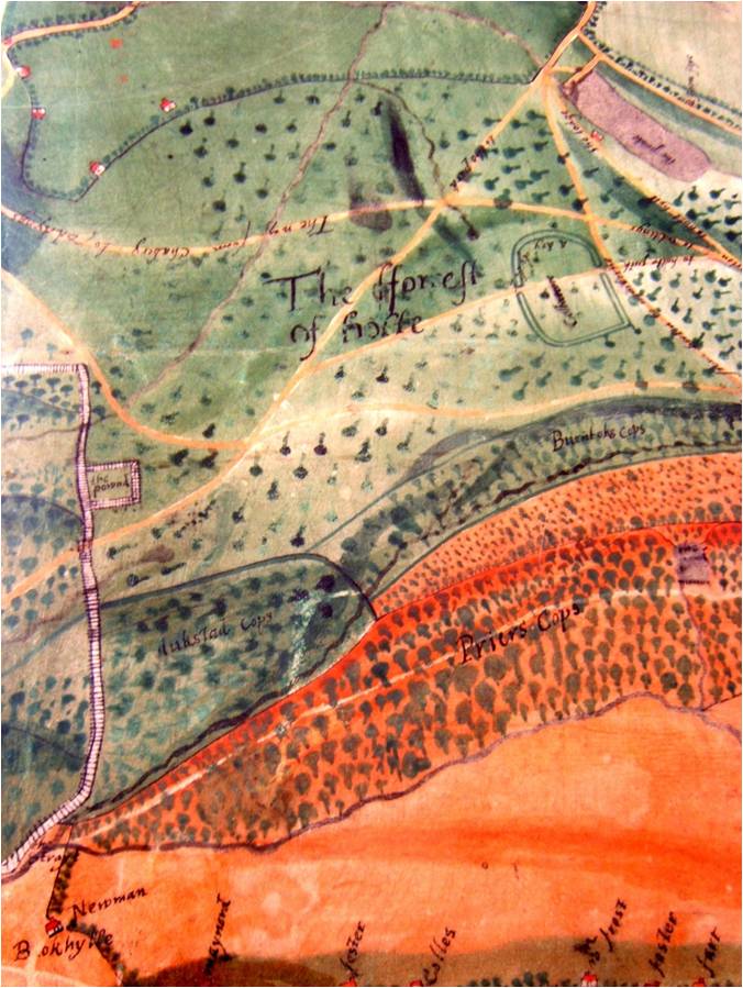
During my research at the Dorset Records Office I came across this colourful map (D.BKL.1600) painted on a single calf skin (it is skin shaped rather than squared off). It was made around 1600, shows houses with the names of the families that lived in them, but is also shows an earthwork called ‘Colebarrow’. In an article by Jeremy Harte in 3rd Stone (1999 Issue 33 pp5-7) magazine it was suggested as more likely to be a Neolithic henge rather than a place of settlement due to the poor soils. Though its 150m diameter (centred on OS grid ref SU0344205733) is consistent with both a small Iron Age hillfort, and a fortified late Bronze Age – early Iron Age farmstead. It may, of course, have been used as both. The slight earthworks can still be followed round most of their course which is marked by a hexagon of field boundaries. A public right of way passes along side the northern edge and across the interior. The site is partly covered by houses and Hope Farm.